Museum Maps
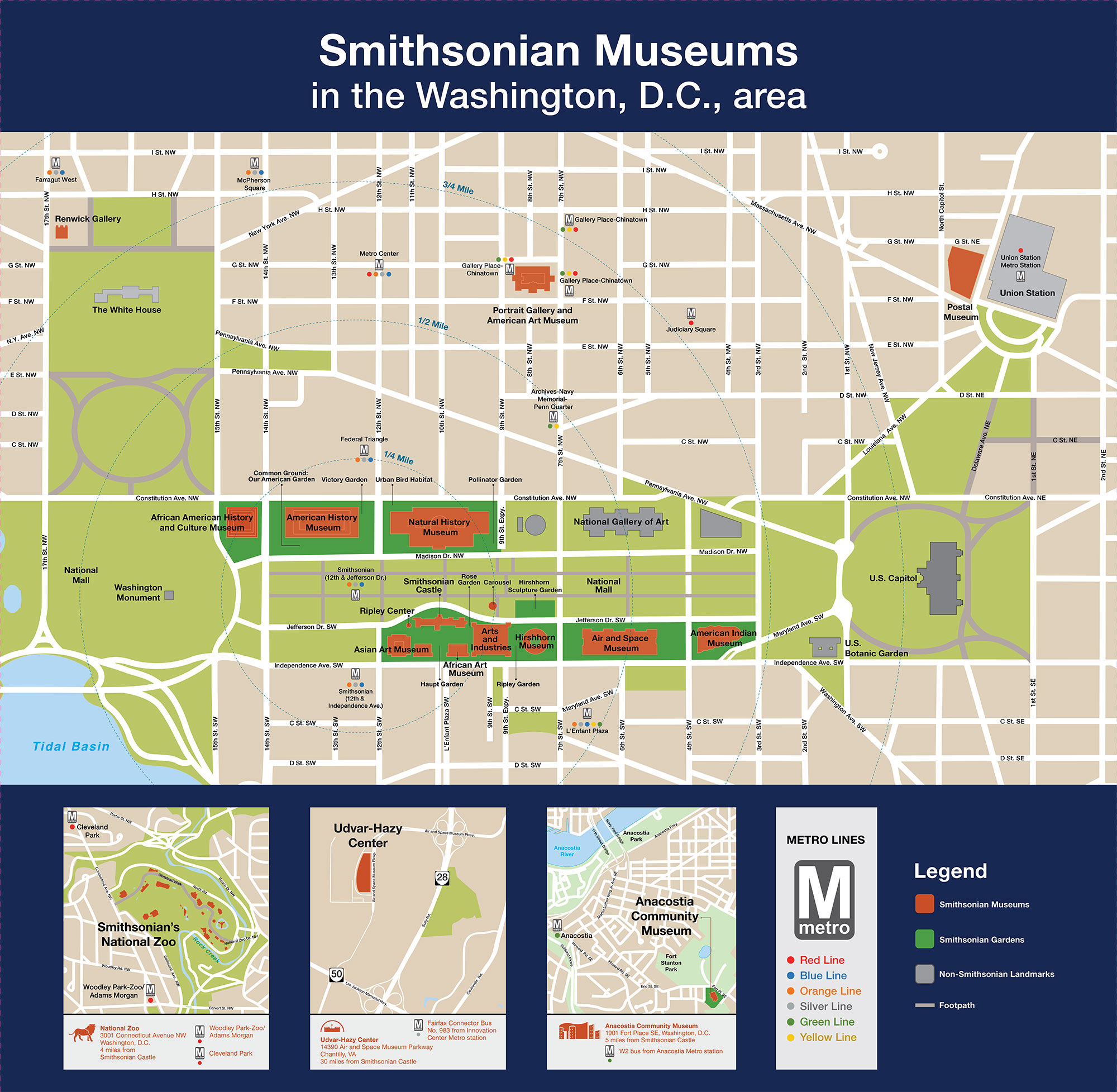
- Map for Smithsonian Museums in the Washington, D.C., Area (PDF) with Metro subway stops and non-Smithsonian landmarks.
- Accessibility Map for Museums on and Near the National Mall (PDF) with accessible entrances, parking, and more.
Museums by Location
Select a museum for detailed information on its hours, address, closest Metro stop, parking, and more.
Museums on and Near the National Mall
Most Smithsonian museums are located around the perimeter of the National Mall in Washington, D.C., from 3rd to 15th Streets between Constitution and Independence Avenues, approximately 1 mile (1.6 km).
- African American History and Culture Museum
- African Art Museum
- Air and Space Museum
- American History Museum
- American Indian Museum
- Arts and Industries Building
- Asian Art Museum Freer Gallery
- Asian Art Museum Sackler Gallery
- Hirshhorn Museum
- Natural History Museum
- Smithsonian Castle
Four additional Smithsonian museums are located within a mile and a half (2.4 km) of the National Mall. The American Art Museum and Portrait Gallery share a building.
Museums Elsewhere in D.C. and Virginia
Three Smithsonian museums are in surrounding neighborhoods accessible by public transportation.
- Anacostia Community Museum, D.C.
- Smithsonian's National Zoo, D.C.
- Air and Space Museum Steven F. Udvar-Hazy Center, Virginia
Museums in New York City
Smithsonian Brochures
The Smithsonian Pocket Guide (PDF) is a map-sized Smithsonian-wide visitor guide that folds down to fit in your pocket. It is available at Washington, D.C., area information/welcome desks in English and Spanish. It is also available at the desks in braille and large-print format (English). Current as of 2023.
Print-friendly versions: